Where is Preston Village?
Many city residents today ask ‘Where is Preston Village?’
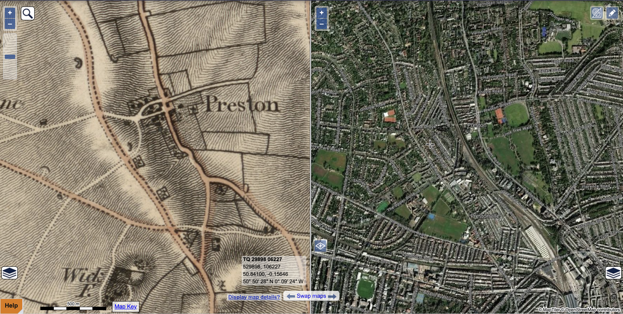
Like many historical places in England, there is no clear boundary even though maps of Preston have been published since 1813
The following maps are ‘official’ and ‘unofficial’ depictions of the place variously known as ‘Preston’ and ‘Preston Village’.
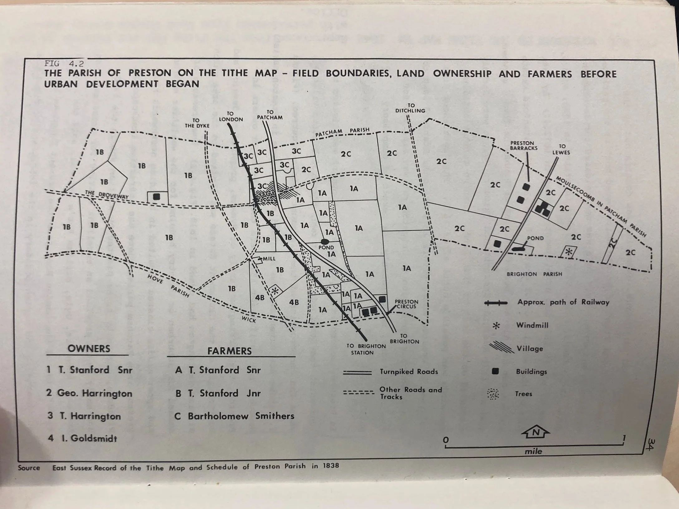
according to the tithe map and schedule of Preston Parish, 1838.
Note the village as highlighted as the lined area on the junction.
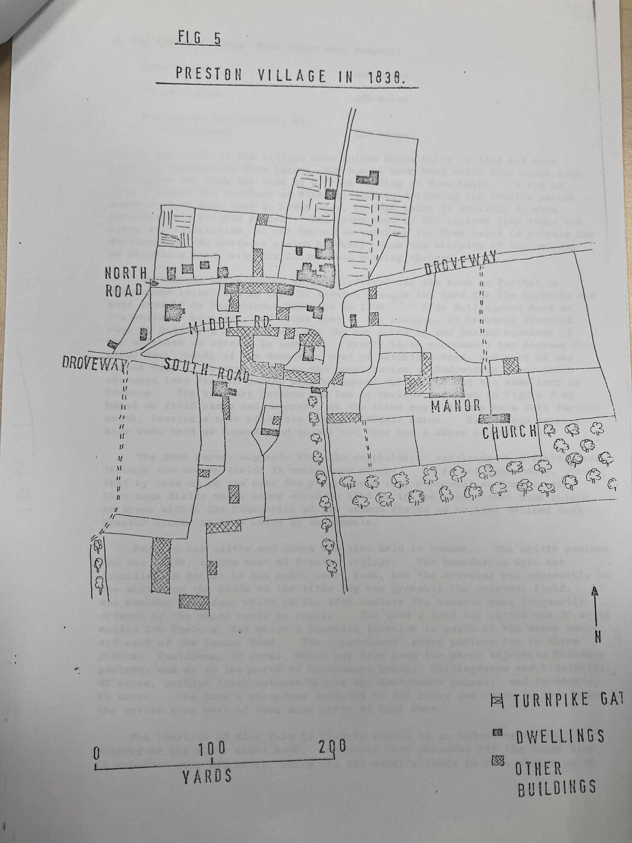
A depiction of Preston Village in 1838 from a pamphlet available in the Brighton Archives (the Keep)
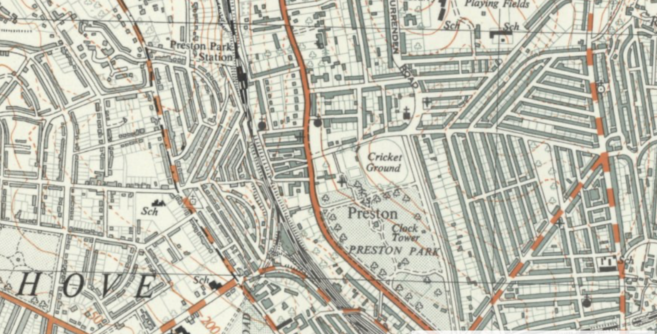
in 1880, according to the Ordnance Survey
Named as ‘Preston’ and standing alone from Brighton to the south, but defined on its western boundary by the railway with agricultural fields and The Drove to the east. The villas & homes to the north of the village had already spread as far as Withdean.
in 1958, according to
Ordnance Survey
A 1958 view of a newly suburban Preston centred on the Park.
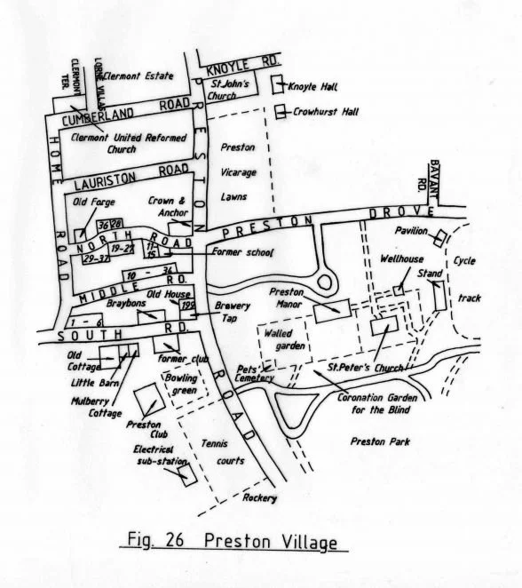
in 1990, according to the Encyclopaedia of Brighton
A gentle interpretation of the village in 1990 by producers of the Encyclopaedia of Brighton & Hove in which Preston Village stretches from the Rockery in the south, to the Velodrome in the east and St Johns the Evangelist Church & Clermont Estate in the north.
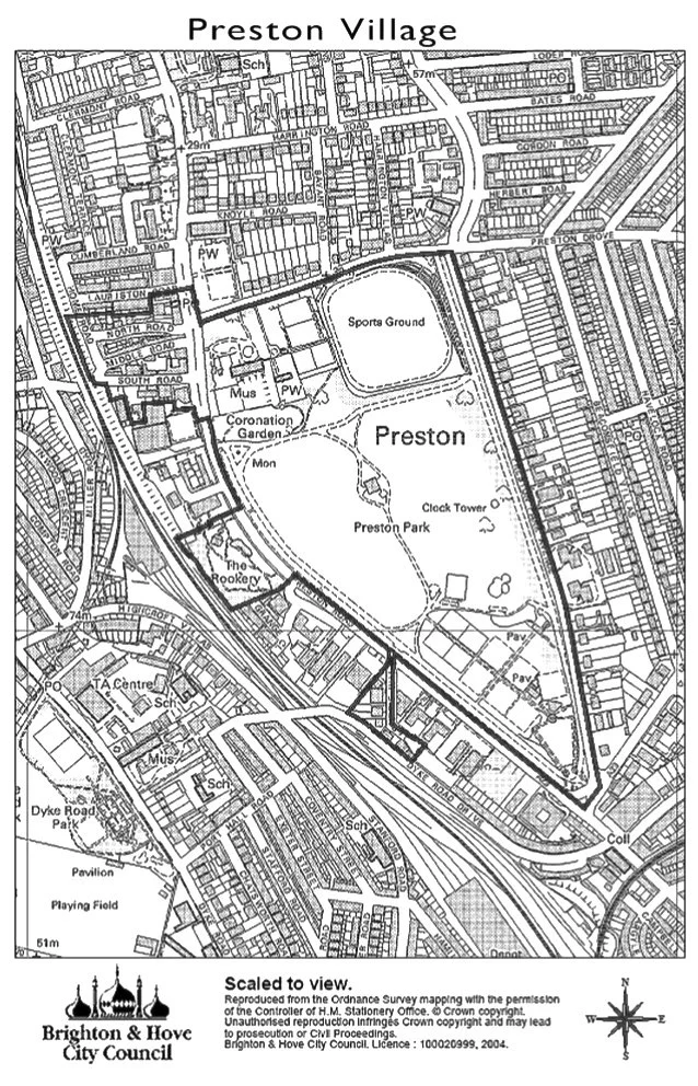
in 2004, according to Brighton & Hove Council
The Conservation Area Map from 2004 defines Preston Village as including the whole of Preston Park, including the ‘Rookery’ and North, Middle and South Road but excluding Lauriston & Cumberland road and the Preston Bowls Club.
in 2025, according to Brighton council parking department
A modern bureaucratic interpretation of Preston Village is proposed by the Preston Village Parking zone which stretches north beyond Preston Park train station but its easterly boundary is the A23.
Where do you think
Preston Village starts & finishes?
Tell us your view using our interactive map below:
